
"Slow The Flow" vs "Get The Water Away"
May 2024
There have ben a number of people, over the years, who have questioned the basic approach of "Slowing the Flow".
"What we need to do", they say, "is to get the water away faster. To drain the fields more efficiently, dig out the ditches and dredge the rivers."
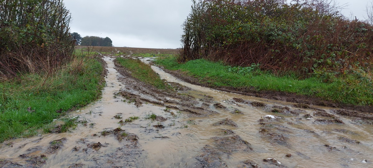
They have a point - nobody wants to see fields under water which can't be harvested, cultivated or sown. But if the purpose of our entire agricultural landscape is to be drained for cultivation, we run into several problems.
Excess water, after storms or prolonged rainfall, is an obvious issue. But so is lack of water in prolonged dry or drought conditions. Climate change, which delivers extremes of both rainfall and drought conditions, makes these matters far worse than they were when the land drainage was designed and installed. So we need to look at how the land can be made more resilient to these extremes - and just draining it faster only deals with part of the problem - and it sets up other problems in its wake.
Where does the water go?
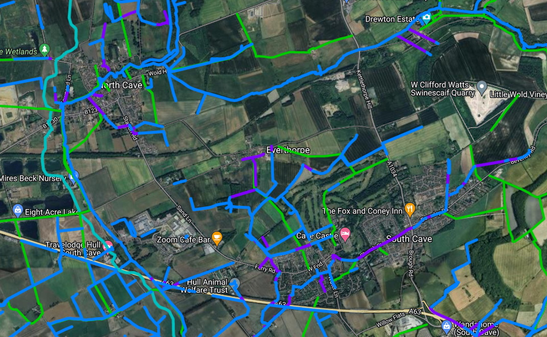
If we can get water rapidly off our fields and through our land drainage systems, where does it go? Looking at the maps such as our Google Maps here, the purple lines are culverts. Like road bridges, and even the Mills that are dotted along the becks in our villages, these form pinch-points, which can prevent the free-flow of water. The result is that storm-water backs up, the levels get raised, and flooding can happen. Short of demolishing every man-made structure (house, road, bridge) along our becks, ditches and natural flow-paths, there is nowhere that we can get the water away to, without badly affecting a lot of people.
Even if we could get storm-water safely past all of those pinch-points, past North Cave, South Cave and Ellerker, it ends up in the flatter lowlands - the 'Humberhead Levels'. This is the flat area that, historically, was the floodplain for the Humber. In this area, the drainage becomes the responsibility of the Ouse and Humber Drainage Board. Does all that water drain safely and easily out to the Humber? No, it's not that simple.
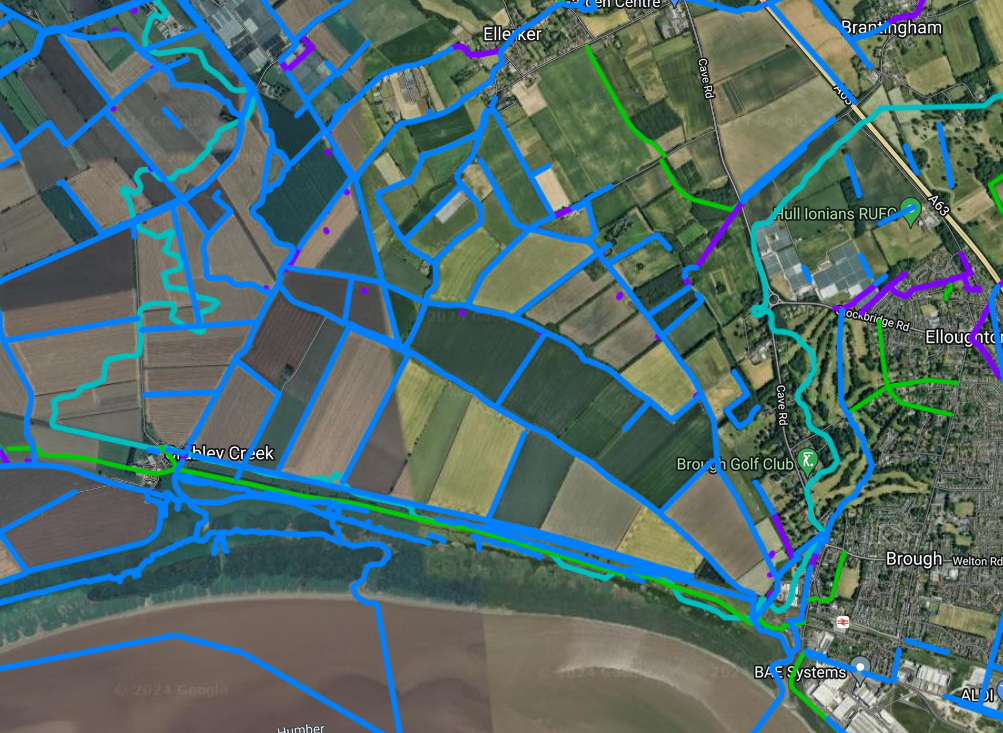
The Humber outfalls (at Crabley Creek and Brough) are all tidal, so they can drain by gravity some of the time, but need to be pumped the rest of the time. This uses huge amounts of electricity and costs the OHDB (and therefore the local landowners) a great deal of money. And, just to make matters worse, a steadily rising sea level means that the Humber outfalls are increasingly under water and requiring pumping. Climate change again!
Finding the balance
We - and many others - would argue that we need a better balance between 'Slowing the Flow' and 'Getting the water away'. If we can hold back storm water for long enough to reduce storm peaks, but without making fields unusable, we may have a way to deal with some of what climate change is throwing at us. Some of that will involve better soil management. For a great introduction, see the video/presentation about Soil Management on our Agricultural Workshop page.
And some of it will involve using marginal land to detain water. With some creative thinking and collaboration, it may even be possible to drain productive land more effectively, whilst making space for water in marginal areas - such as parts of Drewton Beck.
Recommended viewing
Finally, we would recommend this excellent YouTube video, which explains why we need to manage rivers and drains differently A New Way to Manage Rivers.